
Marlin Verhoef farms a quarter section northwest of Prairie City, in Jasper County, and there is a shallow crooked channel running down the length of it that he has never once put a seed in. He is seventy-one. His father did not plant it either.
The rule, the way he says it, is not about conservation.
"You don't farm the draw. The draw farms you."
He said it on the tailgate of his truck in the spring of 2035, pointing at the thing with a gloved hand, in the tone of a man stating the price of diesel. He was not being wry and he was not quoting anybody. Asked where he got it, he said his father, and that his father had not got it anywhere, it was just what the ground did.
What would have to be true
Take the rule at full strength, because at full strength it is a good rule and Verhoef is not losing money on it.
For skipping the draw to be correct as an economic decision, the draw has to be ground that reliably returns less than it costs to plant. That is not a hard case to make. Water stands there after a rain, so the soil goes anaerobic and the nitrogen denitrifies out of it as gas. Seedlings in a saturated seedbed drown or damp off. Working wet ground compacts it, and compaction is not a one-season problem. The draw is the last part of the field fit to drive on in April, so planting it means either waiting on the whole field or making a second pass. Harvest has the same problem in reverse.
Any one of those is a reason. Together they are a strong reason, and a farmer who plants the draw anyway because it looked fine in August is a farmer who has not farmed it in a wet year.
So the rule survives the steelman. It is a correct instruction. The question is what it is an instruction about.
What the rule is measuring
The draw is not a soil type. It is the line water takes leaving the field.
That is the whole of it, and it is worth being exact, because the two things correlate closely enough to hide inside each other for a century. A concentrated flow path is wetter, and it is wetter because water from a large upslope area converges into it. Where water converges it also carries, so the draw is simultaneously the wettest ground, the most eroded ground in its upper reaches, and the most deposited-on ground at its foot. All of that shows up as bad yield. None of it is a property of the dirt. It is a property of the position.
Verhoef's rule is a hydrology map. It has been read, for three generations on that quarter section, as a soil report.
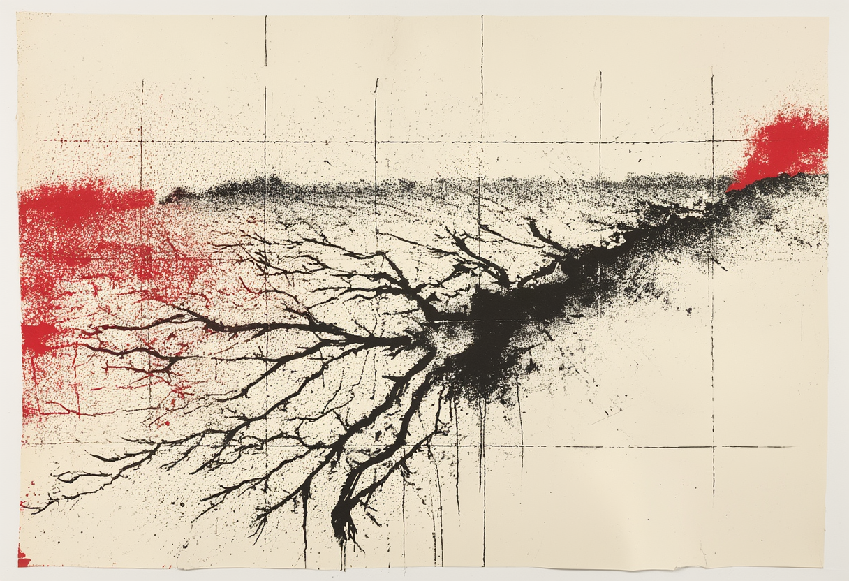
Figure 1. The draw on the Verhoef quarter, drawn from the farmer's description rather than survey data. The red mark is the outlet.
Which way it points
The arrow is the interesting part, and it points downstream rather than down.
A decade of work at Iowa State settled what the draw is worth as a position. Between 2007 and 2017 a team led by Lisa Schulte Moore ran twelve small watersheds at the Neal Smith National Wildlife Refuge outside Des Moines, converting a share of the cropped area in some of them to strips of reconstructed prairie and leaving others in continuous corn and soybeans as controls.1
Converting as little as ten percent of the cropped area cut soil loss by ninety-five percent against those all-crop controls. Phosphorus in surface runoff fell seventy-seven percent, nitrate in groundwater seventy-two percent, and total nitrogen in runoff seventy percent. Pollinator and bird abundance more than doubled.2
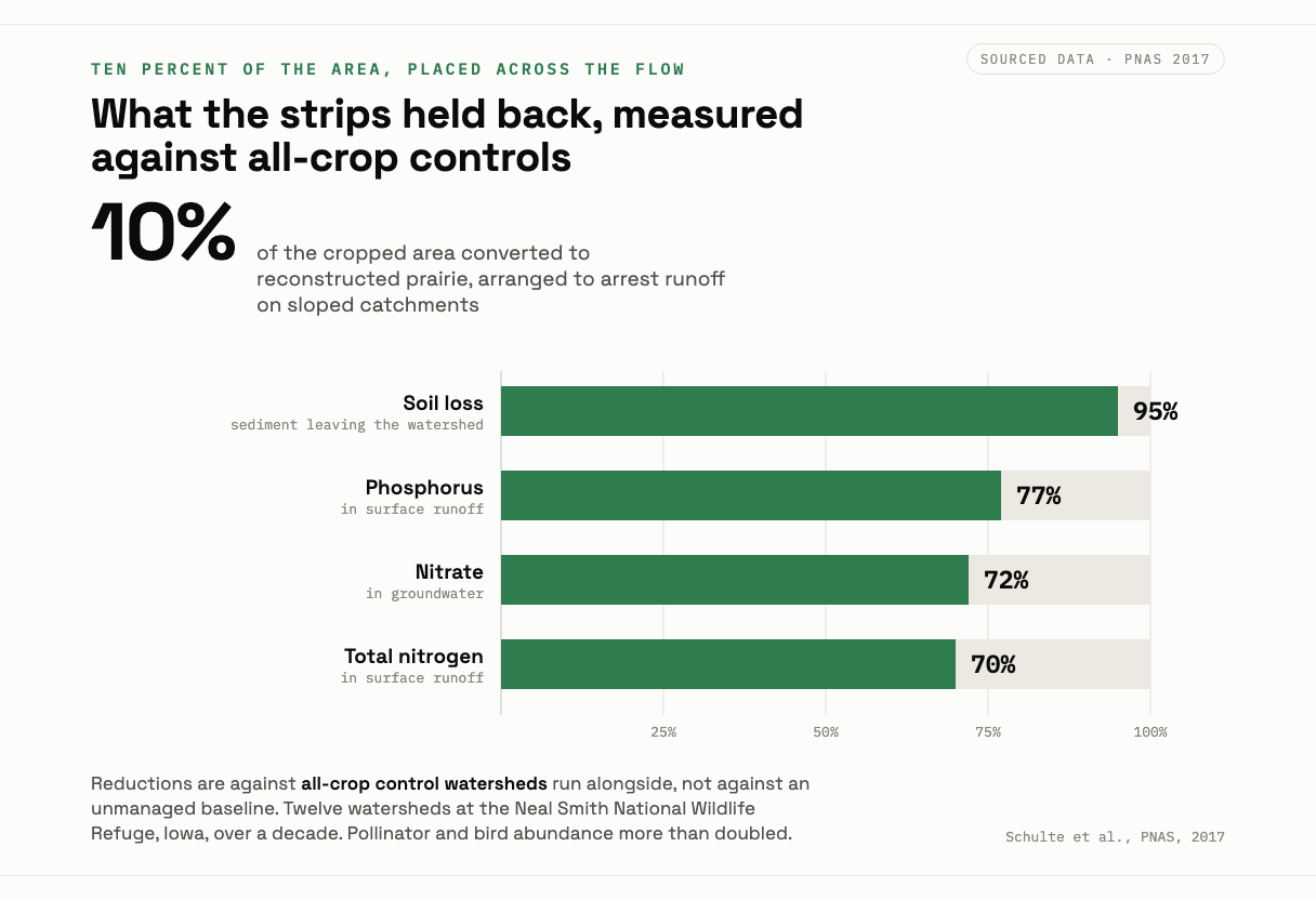
Figure 2. Reductions measured against all-crop control watersheds, not against an unmanaged baseline. The ten percent figure describes area converted, not the share of the field doing the work.
The number that travelled was the ten percent. The number that mattered was where it went. The strips were arranged to arrest runoff on sloped catchments, which is to say they were put across the flow, at the positions the water was already using. Ten percent of a field scattered as a border, or squared off in a corner the sprayer misses, is ten percent of a field doing very little. The active ingredient is position, and the draw is the position.
Which makes Verhoef's refusal to plant it a hundred-year-old, unlabelled, unfunded version of the practice, arrived at from the opposite direction. He is not filtering anything on purpose. He is declining to lose money, and the filter is a side effect of where the losing money happens to be.
That side effect used to be widespread and it stopped being widespread for a reason that had nothing to do with agronomy. In 1973, with grain prices up and the reserve drawn down, Agriculture Secretary Earl Butz told farmers to plant fencerow to fencerow and to get big or get out.3 Fencerows were plowed under. Wet ground was tiled and drained.4 Tile and horsepower between them removed the constraint that had been siting those accidental filters for free, and the draws got planted, and what the draws had been holding went down the watershed.
The strips are the deliberate reinstallation of a thing a constraint used to place for nothing.
The live one
The same error is running right now, at scale, with better instruments and the arrow pointed the same way.
A combine yield monitor produces a map of the field, and that map is the foundation of most variable-rate fertility prescriptions written in the Midwest. The low-yield zones on it get read as the poor ground, and the prescription adjusts phosphorus and potassium accordingly, more here, less there, at a resolution the 1970s could not have dreamed of.
Cory Willness of CropPro Consulting has spent years arguing the foundation is wrong. His objection is empirical: "fifty per cent of the time when we make those yield potential maps, whether it's long-term historic yields or long-term historic images, there's no correlation between the years." A map that disagrees with itself between seasons is not describing a stable property of the dirt. His alternative puts three layers underneath the zones instead of one, soil and water and topography, and his ordering is blunt. Water drives everything.5
So the yield map is substantially a water map. The low zone is low in a wet year because it drowned and low in a dry year because the hilltop above it shed its moisture downslope and went short. The pattern moves because the weather moves, and the dirt does not.
Prescribing phosphorus to that zone treats a position as a deficiency. It is Verhoef's rule with the sign flipped and a subscription attached: he reads the flow path and declines to plant it, the prescription reads the same flow path and fertilizes it harder. Both of them are looking at an accurate picture of where the water goes. Neither of them is looking at a picture of what the soil is.
And the phosphorus does not stay. It is in the one part of the field engineered by gravity to leave.
Editor's note. Category: wrong arrow. Filed to the Almanac desk. Marlin Verhoef and the Prairie City quarter section are a composite drawn from Jasper County farming practice, and the rule as quoted is a composite phrasing, not a transcription from a single named source. The STRIPS watersheds, the reductions, the Butz directive and the Willness objection are real, current and sourced below. The topic as filed carried a phosphorus reduction of ninety percent; the published figure measured against all-crop controls is seventy-seven percent, and that is the number used here.